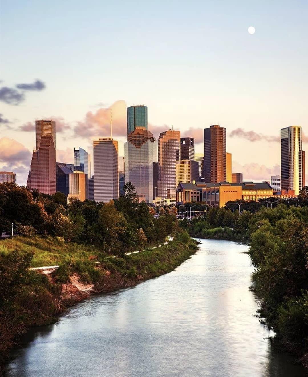
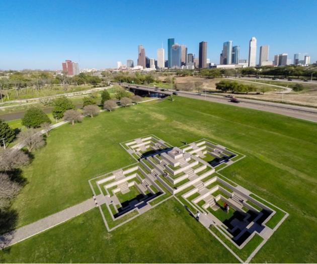
Buffalo Bayou Park follows the water just west of downtown Houston, but it does not feel separate from the city. Across 160 acres, trails, native landscaping and public art share space with views of the skyline. A walk from Sabine Street toward Waugh Drive offers a way to see that mix without trying to cover the entire park.
Begin at The Water Works
The park extends from Sabine Street to Shepherd Drive, between Allen Parkway and Memorial Drive. At its Sabine Street end, The Water Works has a visitor center at 105-B Sabine Street. It makes a starting point for a walk west along the bayou, with downtown still close behind you.
Before following the trail, take in the relationship between the water, the planted parkland and Houston’s buildings. The skyline is part of the view here, not a distant backdrop. As the path continues west, the balance changes: trees and landscaping draw attention to the bayou, while the city remains visible from parts of the park.
A reservoir beneath the park
Buffalo Bayou Park also contains the Cistern, a former City of Houston water reservoir. Decommissioned in 2007 after an irreparable leak, the 87,500-square-foot structure now serves as a public space for visual art and sound installations. Its scale and former purpose make it a different kind of park feature: infrastructure that can be understood as part of Houston’s cultural landscape.
The Cistern is worth considering separately from the walk above ground. The trails show how the bayou has been made into public space; the reservoir offers another perspective on the city’s relationship with water. If you want to include a visit inside, look up current Cistern visit information rather than assuming it is part of an ordinary walk through the park.
Why this green corridor looks the way it does
The bayou banks have not always had their present character. Land in this area was set aside for park use in stages during the 20th century. In the 1950s, repeated flooding prompted work that removed vegetation from the banks and straightened the bayou; according to the park’s history, that effort did not improve drainage as intended.
The current park reflects a later effort involving Buffalo Bayou Partnership, the Kinder Foundation, the City of Houston and Harris County Flood Control District. Its updated form opened in 2015. Native landscaping, gardens and trails are therefore more than incidental scenery: they are part of a redesigned public corridor beside a waterway that has also been heavily altered.
Follow the bayou toward Waugh Drive
From the Sabine Street end, keep the bayou as your guide and head west toward Waugh Drive. This is a portion of the park, not its full length: the green space continues farther west to Shepherd Drive. Choosing Waugh Drive as an endpoint leaves room to notice the changing views and park features rather than treating the trail as a route to finish.
The trails are used for both walking and cycling. Buffalo Bayou Partnership asks cyclists to ring when passing and to slow down around other trail users, useful reminders that this is shared public space. Along the way, look for how the planting, art and paths sit between the bayou and Houston’s streets. That arrangement is what distinguishes the walk: nature and city stay in the same frame.
End at Waugh Drive or continue west if you want to explore more of the park. Either choice reveals Buffalo Bayou Park as a place shaped by Houston’s water, infrastructure and public life.
Sources: buffalobayou.org · en.wikipedia.org



Comments